 |
|||||||||||
|
|
|
|
||||||||
WCRA
website promoting Stage and TSD Rally Sport in
British Columbia |
|
||||||||||||||||
|
||||||||||||||||
Saturday
morning’s drivers’ meeting brought
the news that there would indeed be snow, but
no snow banks to soften landings for errant cars
(“winter-roads-summer-ditches”). There
would also be mud, some icy mud, some snow over
ice, some fresh snow over compact snow, and some
dry gravel. Typical Totem. Road and weather conditions
in Central British Columbia are unpredictable
in November and provide arguably the most varied
and difficult Time-Speed-Distance rally roads
in North America. The RallyMaster/Organizer team of Fred and Shelley Wiedemann sent 25 cars out onto the back roads south, then west of Cache Creek, for the Hat Creek Regularity, with the note to expect very icy conditions 12km into the first section. This notation seemed improbable as the section begins with a dusty uphill hairpin at 62km/h. The first checkpoint is hidden in the mix of pine trees, white-barked birch, and a blanket of yellow foliage. A moment or two later reality and concentration focus on the instruction: “Caution!!! Exposure left”. (Single cautions ! are generally interpreted as corners or hazards that if ignored may cause you delay, double !! may cause damage to your car, triple !!! may cause damage to your person.) The dust is gone, the road is now rutted sticky mud. As the rally gains elevation through the conifer forest and crests a ridge there is snow, and a checkpoint, just short of the 12km mark at “Hairpin R Caution!! Exposure next 500km”. Then, executing a series of hairpins on ice, dropping dramatically off the ridge there is another checkpoint, this one in a hairpin left. |
||||||||||||||||
With
only a brief time to “relax” from
the ice, competitors began a steady elevation
gain within the rolling hills and valleys of Upper
Hat Creek Ranch (…were those caribou?).
Punctuated by “Caution!!! Road goes Right
over crest with Exposure L”, speeds are
up to 68km/h here through the ranch, then dropping
steadily, we pass two more checkpoints, to Highway
99 and the transit west through scenic Marble
Canyon to Pavillion. |
||||||||||||||||
Pavillion-Clinton
TSD begins with a steep switchback climb through
several long hairpins at 52, then tops out into
more ranchland at 72. Another drivers’ meeting
warning was here at 14km into the section: “Slow
Down! Very Slippy!” The instruction read:
“Hard Left – Caution!! Off Camber
downhill! Straight ahead is not an option!”
As the checkpoint crew for this corner was setting
up, a wood cutter lost control of his pickup and
trailer coming UP through the corner. Jack-knifed
into the apex he was well and truly stuck, leaving
only a narrow passage on the outside of the corner.
The checkpoint crew’s triangle warned on-coming
rally cars, causing even slower approaches than
intended. Managing to get past the big Ford’s
front bumper, noticing the checkpoint and cameraman,
anxious teams would later be relieved to find
the checkpoint would not be scored due to the
congestion. The remainder of the section was Hairpin
after Hairpin for 4km, down to two picturesque
mountain lakes southwest of Clinton. Big Bar Road to Dog Creek TSD covered 61.78km at a brisk pace northward past several guest ranch and resort areas with three checkpoints on the western-most loop of the rally. |
||||||||||||||||
| A short
transit brought the rally to the longest TSD of
the day at 88.62km. Big Bar Road to 100 Mile House
contains wet gravel, snow in the corners in the
shade, rutted mud (think chocolate pudding), and
snow over ice. At various points, the front runners
all admitted to being very late, and luckily nearly
every one was able to recover before the next
checkpoint. That is, all but one team, who missed
an instruction, were seven minutes late at one
point, and after finding their mistake could only
make up three minutes before a control and effectively
the end of their hopes at a decent score. (Exhibiting
great sportsmanship, this team volunteered to
work checkpoints on Day Two. “We were still
able to run the course at 70 to 80km/h”
to stay ahead of the rally) Fuel and snacks in 100 Mile House, then north to Spring Lake TSD where the second leg of the rally begins eastward past Canim Lake. Spring Lake is a moderate to brisk 25.84km regularity, roughly split in half by a slower twisty section covering 4km at 32, and closing with just under 8km at 68. |
||||||||||||||||
The last
TSD of the day is usually well populated by all
the checkpoint crews that have been spread over
the countryside, now concentrated in a smaller
area. Totem was no exception, with six controls
in 56km, including two within 2km - Pay Attention!!
– and, the last checkpoint less than 2km
from the end. |
||||||||||||||||
Wells
Gray Inn at Clearwater was the overnight headquarters
affording choices of quiet dining, spirited celebration,
and a live band. Scores for Day One were tight,
with a tie for first with SIX points. (Tie breaker
would have been 18 zeroes each, then two ones
each, then two twos each, etc, etc. Absolute zeroes
went to car 1 with 9, over car 5 with only 8.) |
||||||||||||||||
Day Two
drivers’ meeting presents several notes
about the route including a mention of snow scraping
the bottom of the car for 5km on the second regularity,
and a small tree across the road (too big to move,
but not too big to drive over). The transit leaves
Clearwater due south toward Kamloops and soon
provides a stop in Little Fort for food and fuel,
before the rally climbs steeply up Boulder Mountain.
In the valley it is raining, but soon becomes
mixed rain and snow over mud, snow in the shaded
corners, and eventually settles for gravel mixing
long straights with twisty sections through the
trees. We were warned of cows and golf carts on
the road, but both seemed to have sense enough
to find shelter elsewhere from the near freezing
drizzle. |
||||||||||||||||
A very
short transit just north of Barriere takes us
to the rally’s first real test on snow.
85km Lake Road TSD begins with a steep gravel
climb into the snow, hairpins, and a control.
As the route winds through a recent forest fire
area the snow deepens and of course the speed
increases. The front running cars are all All-Wheel-
or Four-Wheel-Drive and concentrate on tweaking
the computers for “zeroes”. Further
back in the two-wheel drive group, the concentration
is just to stay on the road. One did not. The
resultant extrication (no damage, just late) delayed
several cars. |
||||||||||||||||
Shortly
after passing the third checkpoint of the section,
speeds increase to 62, 68, 58, and back to 68
for nearly 30km of smooth open road, with only
a few “non-rally” vehicles. A 90°
right across a bridge is “a bit icy”.
But the next “KL, Caution! Tight”
is just an ice rink and of course, the road immediately
begins to climb. Wheel spin, no hard-points for
odo correction, and a checkpoint, keep drivers
and navigators busy. Not knowing exactly where
the timing line is, we show 2-early at the entrance,
on-time at the bridge, and 2-late at the exit.
Unable to correct our factors in time, we would
later find we were 5-early—driver having
too much fun? We recover composure for the last
checkpoint at zero, however the first hairpin
in the snow (late) and the double-left (early)
will more than double our first day score. |
||||||||||||||||
The “stretch”
transit allowed teams to compare notes, relax
a bit, and enjoy an open-air lunch. A cold breeze,
but no rain or snow. |
||||||||||||||||
|
||||||||||||||||
A few
minutes later we are caught by our “twin”,
I see my own car in my rear view mirror. Alas,
no road fatigue hallucination, it is only a checkpoint
crew in an identical car trying to regain their
position ahead of the field after missing a turn
earlier. They pass, and my thought is they may
actually make it with only four more cars to go.
They may also prepare any local traffic for me…
for better or for worse! (We never saw them again
until the finish, learning they had made yet another
wrong turn and followed coincidental, but wrong,
instructions for several minutes toward Tranquille.) |
||||||||||||||||
“KL
at Red Lake DR” brings back a vague memory
of rallies past. On previous Totem and Thunderbird,
this section of road has been used uphill in the
mud, uphill in ice, and downhill in snow over
ice over mud. The first corner downhill is: “Caution!!!
Hard R Exposure L”. It is a very long drop
into the valley below. Previous years’ speeds
have been 24km/h and difficult to maintain. This
year 36km/h is tame, but there are muddy spots
and no hard-points for nearly 3km. The traditional
checkpoint location at the last hairpin is surprisingly
vacant. Could this be where our “twin”
was supposed to be? |
||||||||||||||||
Shortly
after the drop into the valley, rally cars were
treated to close-ups of cows. Throughout the two
days there had been cautions to watch for cows
on the road. All previous encounters had been
casual, at a distance. Now, however, even after
course-opening cars and several rally cars, these
big white-faced Herefords had not given up their
claim for the road. 44km/h into a cow is not an
option, so ever so slowly, we crept between cows—their
heads lowered, nostrils still above the side mirrors,
we passed. The ear tag on the closest one read
“100” on it’s right ear and
“26” on it’s left ear (thanks
Satch) and thankfully no slobber on the side windows. |
||||||||||||||||
The last
23km of the 95km TSD are familiar to Totem and
Thunderbird alike: The westward climb to maximum
elevation, the two or three “likely”
checkpoint locations, and the hairpin switchbacks
south down to the highway. With this year’s
dry conditions the conversation drifted off to
commentary on topics such as “Glenn’s
second corner”, “RJ’s corner”,
“Ron’s corner”, “Jeff’s
corner” and so on… We’ve paid
attention to the route book, to the road, and
to the clock. We take a zero for 94.92km, but
will it be enough? Three other cars would do the
same. Previous indiscretions have taken their
toll, however, and we move from tied for first
to tied for third, a whole 4 seconds out of the
lead. |
||||||||||||||||
Lee and
Rod Sorenson, brothers (and our teammates) from
the Sacramento area would repeat their 2003 Totem
win for First Overall with 11 in Lee’s RS2.5.
Perennial driving threat, fresh from an Alcan
5000 win, Gary Webb from Arizona, and John Kisela
from Seattle, would take Second with 14 in John’s
Legacy. Third Place tie was between Ron Sorem
and Max Vaysburd, from the Seattle area, in a
Legacy Turbo, and RJ and Ren Carroll, son and
father team from Kamloops, in Ren’s WRX.
The tie was broken by most zeroes, 29 for Ron
and Max versus 27 for RJ and Ren, still very,
very close. RJ and Ren will take First Unlimited
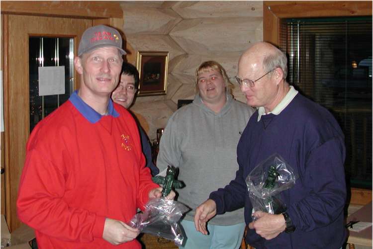
and First Overall in the 2004 BC TSD Rally Championship. |
||||||||||||||||
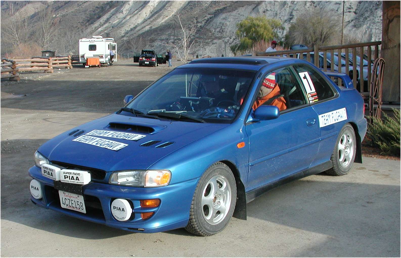
First
Calculator/Equipped went to Martin Chung and Christa
Monasch with 28 in the bright red stage rally
Impreza, also taking First Calculator in the BC
Championship. Second Calculator/Equipped went
to Jeff McMillen and Marvin Crippen with 51 in
a WRX, despite having no odo sender for Day Two,
and running a back-up system that had added kms
erratically. Jeff and Marvin will repeat as PCC
Champions for 2004. |
||||||||||||||||
Paper
and Pencil class (SOP) again went to Dan and Stu
Fealk with Dan keeping their Subaru XT6 on the
course and Dad doing the calcs. Dan and Stu will
take First Paper in the BC Championship. |
||||||||||||||||
In yet
another tie at 247, First Historic Equipped went
to Mike Palm and Garth Hales in the 1973 Super
Beetle, and First Novice went to the Calgary team
of Johnny Summers and Brendan Youngberg in Brendan’s
2005 Impreza RS – ON THEIR FIRST RALLY!
They have already been heavily recruited for Novice
team members at Thunderbird. |
||||||||||||||||
First
Historic went to Richard Childs and Helen Welter,
making the trek from Alberta in the 1974 BMW 2002tii
to also wrap up their season try for First Historic
in the BC Championship. However, William McRae
and Dave Harms Second Historic at Totem in the
1969 VW Beetle was just enough to win the BC series
by TWO points. |
||||||||||||||||
Our “twin”
was Shawn Edstrom and Geoff Gauthier from Kamloops,
who worked this event, but will be awarded First
Novice for the 2004 BC TSD Championship. |
||||||||||||||||
Series
sponsor Specialty Subaru must be enthusiastic
over the 13 Subaru competitors and 3 more Subaru
checkpoint cars, representing the manufacturer. |
||||||||||||||||
Totem
accumulated 700.61km (438mi.) in an area roughly
135km by 95km. For complete results, photos, and information on other BC events visit: www.rallybc.com |
||||||||||||||||
All
images are © RallyBC.com and the author.
Any other use without permission is in violation
of copyright laws. Feel free to view these pictures, or download for personal use only. |